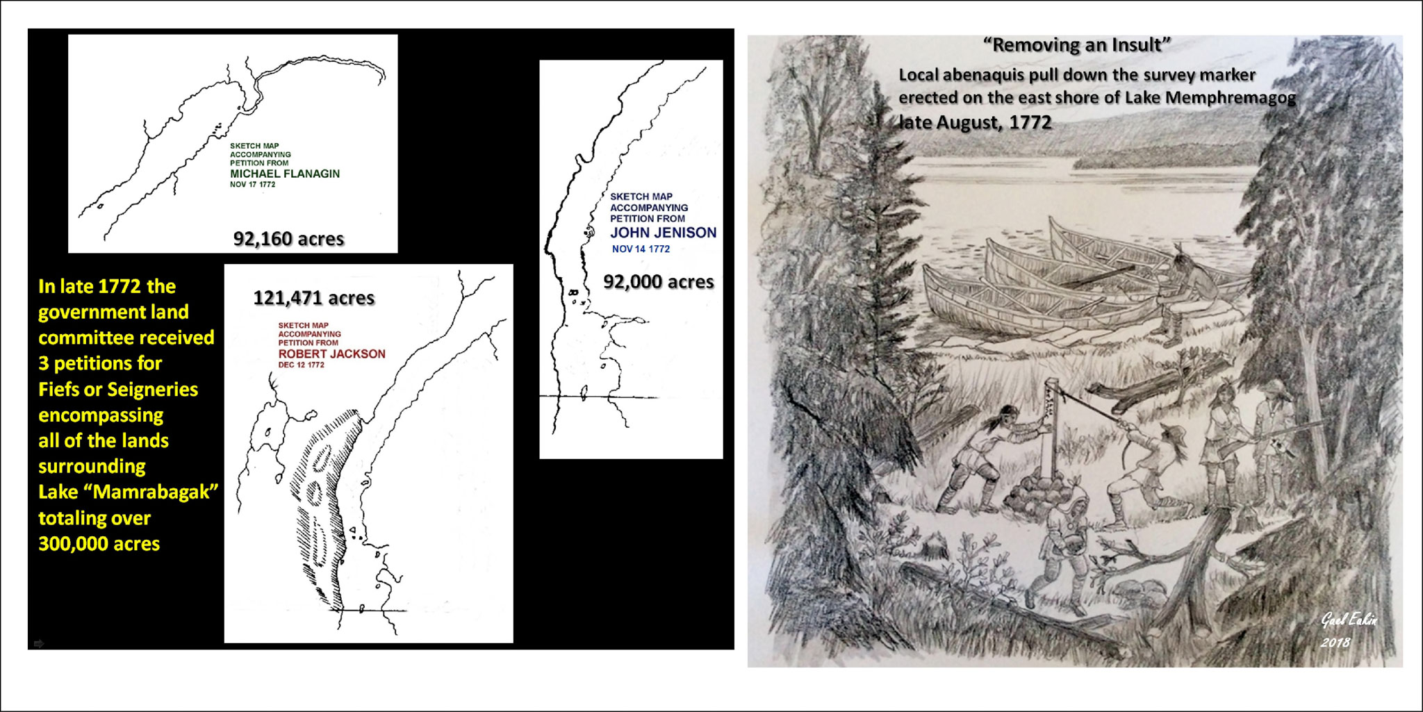
This poster answers the question posed by Poster 5. By October 1st the survey team led by Collins and Vallentine had reached its objective, the point where the 45th parallel intersected with the headwaters of the Connecticut River (Halls Stream). They then returned to Quebec City via Lake Memphremagog, the Magog River and then the St. Francis River. They arrived in the city about October 20th, as Vallentine was writing to his boss, the Surveyor-General of New York Alexander Colden, on October 22nd from Quebec. By mid-November two coordinated petitions for vast tracts of land had arrived at government offices in Quebec, accompanied by extraordinarily-detailed maps of Lake Memphremagog. Further petitions arrived at the Land Office in December and January. The petitioners were all Americans (John Jenison, Michael Flanagin, Robert Jackson) who evidently had colluded with Collins and Vallentine to try and obtain the prime real estate surrounding the big lake. The two weeks taken off from the boundary survey at the end of July and beginning of August were clearly used by Collins and Vallentine to procure a detailed map of Lake Memphremagog. Eventually the petitioners were denied.
The Abenakis had been using the Lake Memphremagog region as a very important resource area (fishing, hunting, trapping) for generations. They must have been astonished that white men would carve a trail in the wilderness, coming from nowhere and going to nowhere, in a dead straight line (well almost) over mountains, through swamps, across lakes and rivers. They would not have been so naïve as to not see its purpose. This scar on their traditional land was a very bad omen for the future. They promptly tore down the post erected on the east shoreline of Lake Memphremagog.