This manuscript map by John Collins produced in 1773 is held by the National Archives (Public Records Office) of Great Britain. It shows the 45th line from the east shore of Lake Champlain eastward to the headwaters of the Connecticut River. In the area of Lake Memphremagog (at left) it shows detailed mapping of the shoreline, interesting annotations indicating the original Abenaki names for various water bodies, and the course of the Tomifobia River as well as Johns Creek. On this map the Tomifobia is known as Panguapsheenas (translates to Rocky River). Johns Creek is called Lewis Creek. Fitch Bay is labelled Loon Bay. Lake Memphremagog is Lake Memrahabegek.
The interpretive map shows that portion of the line surveyed by Collins and Thomas Vallentine. It also shows the deviations of their surveyed line from the true 45th parallel. For the most part the inflections and deviations were to the gain of Americans although the British won a little of that back with a deviation southward near the western end of the line.
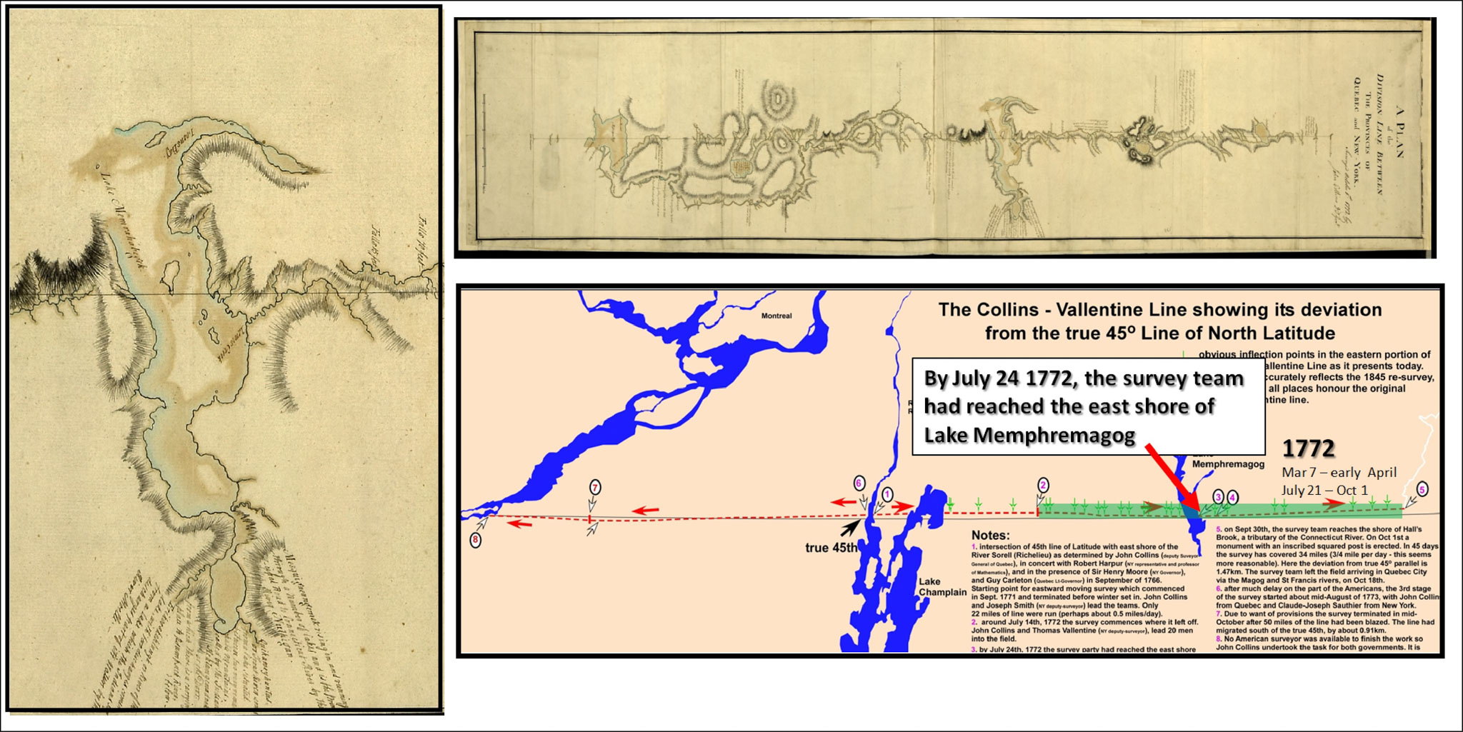
By July 24th the survey team had reached the eastern shore of Lake Memphremagog (Ogden). Then for reasons that initially seemed obscure to this writer, the entire team stayed there for nearly two weeks. Their instructions were to not stop at any water body. What were they doing here?